A significant severe weather outbreak is ongoing across portions of the southern United States this weekend.
Forecasters issued a rare “particularly dangerous situation” tornado watch on Sunday for portions of Texas, Louisiana, and Mississippi, warning that strong, long-track tornadoes were possible.
Dynamics across the region are also capable of supporting very large hail and widespread damaging winds.
While no organized storm activity is expected north of the border, some of this Gulf moisture will stream north toward southern Ontario on Sunday.
RELATED: ‘This is a tornado emergency’: How forecasters warn of grave danger
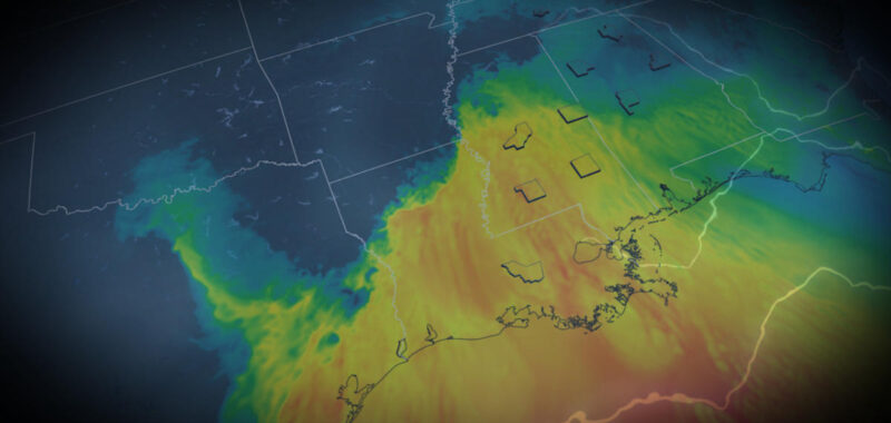
Severe storm risk through this weekend
Warm, moist air surging north out of the Gulf of Mexico is feeding ample storm activity across a large swath of the southern U.S. on Saturday.

The U.S. Storm Prediction Center (SPC) issued a moderate risk for severe weather, which is a level 4 out of 5 on the agency’s scale assessing the threat for severe thunderstorms.
This environment strongly favours tornado development. Some of these tornadoes have the potential to reach EF-3 strength or higher, and could remain on the ground for an exceptionally long time.

Throughout the evening on Saturday, the storms are forecast to merge into a fast moving squall line, with strong winds as the biggest threat in the region as well as nocturnal tornadoes.
Alabama, Tennessee and parts of Georgia will all be on high alert for severe weather through the overnight period.

RELATED: The frightening reason violent EF-5 tornadoes are so rare
We’ll see the risk for severe thunderstorms shift east into Sunday, with the storm threat unfolding from northern Florida through the Ohio Valley. This includes the major air travel hubs of Atlanta, Georgia, and Charlotte, N.C.
A deepening surface low will cultivate widespread thunderstorm activity along a cold front moving towards the East Coast. The atmosphere ahead of the cold front is still tapping into a deep layer of moist, unstable air so thunderstorms are at risk of redevelopment.
Although the risk for tornadic activity is lessened on Sunday, some tornadoes will likely develop, especially across eastern Georgia and the Carolinas where the highest levels of low level shear and instability overlap.
Stay with The Weather Network for all the latest on conditions across the region.
WATCH: Tornadoes spotted as outbreak forecast Saturday in U.S.
Click here to view the video